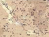
| Nakhchivan
Republic (Naxcivan Muxtar Respublika) |
Azerb.com
|
| |
|
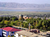
Geography
 This
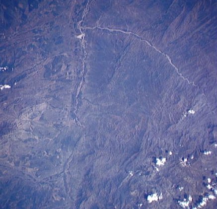
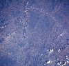
wonderfully atmospheric semi-desert region is separated from the main portion
of Azerbaijan by Armenia. The isolation of Nakhchivan Autonomous Republic
from
the rest of the country is recent, dating only from 1924, when Stalin transferred
the province of Zangezur to Armenian control.
This
wonderfully atmospheric semi-desert region is separated from the main portion
of Azerbaijan by Armenia. The isolation of Nakhchivan Autonomous Republic
from
the rest of the country is recent, dating only from 1924, when Stalin transferred
the province of Zangezur to Armenian control.
The Republic also borders on Iran and Turkey.
The border with Turkey is only 9 km longer, resulting of territorial swap
between Iran and Turkey made in 1932. This arrangement proved providential
to the Republic after the conflict with Armenia, in 1992 the construction
of the Umud bridge across the Aras provided the exclave with a vital
link to the world. During the war proper, the Armenian forces bombed Nakhchivan
but never invaded, taking only the town of Karki.
This was a 'sub-exclave' detached from the main territory and located inside
Armenia, north of Sadarak, near Zovashen. About 2000 refugees from Karki
now live in the main territory. The regional capital is Nakhchivan
city and the second city is Ordubad.
 The
exclave has an area of 5,500 sq. km with a population around
350.000. Nearly 75% of the territory is located at a height of 1,000m and
above - Nakhchivan is known for its majestic mountains - the Daralagez
and Zangezur ranges. The tallest, located in the Zangezur range is Gapydjik
with 3,904 m. The region has impressive volcanic domes and is regularly
visited by strong earthquakes, that of 1931 having been particularly severe.
The
exclave has an area of 5,500 sq. km with a population around
350.000. Nearly 75% of the territory is located at a height of 1,000m and
above - Nakhchivan is known for its majestic mountains - the Daralagez
and Zangezur ranges. The tallest, located in the Zangezur range is Gapydjik
with 3,904 m. The region has impressive volcanic domes and is regularly
visited by strong earthquakes, that of 1931 having been particularly severe.
The southern part of the republic is influenced
by the river Araz, which marks the border with the Azeri populated areas
in Iran. There are no major lakes, only small mountain lakes near Bichanak
and the Arazlisu reservoir, west of Nakhchivan city, near Babek
- bordering Iran.
The climate is continental, becoming
semi-desertic in parts of the pre-Arazian plain. Precipitation is low,
even in mountain areas. Rain occurs rarely but with intensity, often causing
floods due to the sparse vegetation. The only area of forest is located
near Bichanak.
Economy
 The
economy suffered a severe blow in 1988 with the loss of access to both
raw materials and markets, due to the Nagorno Karabakh conflict. Although
new markets are emerging in Iran and Turkey this isolation still persists
to this day, impairing development. The economy of Nakhchivan is based
on agriculture, mining and food processing, however 75% of the republic's
budget is supplied by the central government in Baku. Aid is also provided
by Turkey and several NGOs.
The
economy suffered a severe blow in 1988 with the loss of access to both
raw materials and markets, due to the Nagorno Karabakh conflict. Although
new markets are emerging in Iran and Turkey this isolation still persists
to this day, impairing development. The economy of Nakhchivan is based
on agriculture, mining and food processing, however 75% of the republic's
budget is supplied by the central government in Baku. Aid is also provided
by Turkey and several NGOs.
The Republic is rich in minerals.
Nakhchivan possesses deposits of marble, lime and gypsum. The deposits
of the rock salt are exhausted in Nehram, Nakhchivan and Sustin. The important
Molybdenite mines are currently closed as a consequence of the exclave's
isolation. There are a lot of mineral springs there such as Badamli, Sirab,
Nagajir, Kiziljir where water contains arsenic.
About 90% of the agricultural land is now
in private hands. However agriculture has become a poorly capitalized,
backyard activity. Production has dropped sharply and large-scale commercial
agriculture has declined.
 Over
two thirds of the land are rocky slopes and deserts, therefore the area
of the arable lands is quite limited. The main crops - cotton and tobacco
- are cultivated in the PriAraz plain, near of Sharur and Nakhchivan city.
Three quarters of the grain production, especially winter wheat is concentrated
on the irrigated lands of the Sharur plain and in the basin of the Nakhchivan
river.
Over
two thirds of the land are rocky slopes and deserts, therefore the area
of the arable lands is quite limited. The main crops - cotton and tobacco
- are cultivated in the PriAraz plain, near of Sharur and Nakhchivan city.
Three quarters of the grain production, especially winter wheat is concentrated
on the irrigated lands of the Sharur plain and in the basin of the Nakhchivan
river.
Vine growing in Nakhchivan is an ancient
tradition, in the Araz valley and foothills. Very hot summers and long
warm autumn make it possible to grow such highly saccharine grapes as bayan-shiraz,
tebrizi, shirazi. Wines such as "Nakhchivan" "Shahbuz", "Abrakunis", "Aznaburk"
are of reasonable quality and very popular. Fruit production is quite
important, mainly of quince, pear, peach, apricot, fig, almonds and pomegranate.
Cattle is another traditional branch of
Nakhchivan farming. Due to the dry climate, pastures in Nakhchivan are
unproductive, therefore sheep breeding prevails over other stockbroking.
Winter pastures stretch on the PriAraz plain, on the foothills and mountain
sides to the altitude of 1200 m. But the summer pastures stretch on the
high-mountain area (2300-3200 m). The most widespread sheep variety is
'balbas'. These sheep are distinguished by their productivity and snow-white
silky wool which is widely used in carpet manufacture. Horned and small
cattle are bred everywhere, especially in environs of Sharur and Nakhchivan.
Buffaloes are also bred here.
Processing of minerals, salt, radio-engineering,
farm ginning, preserving, silk products, meat and dairy, bottling of mineral
waters, clothing, furniture are the principal branches of Nakhchivan's
industry.
Although good intentions have been declared
by the government, tourism is still at best incipient. Until 1997 Tourists
needed special permission to visit, which has now been suppressed, making
travel easier. Facilities are very basic and heating fuel is hard to find
in the winter, but the arid mountains bordering Armenia and Iran are magnificent.
History
 Nakhichevan's
earliest claim to fame comes from biblical times, as Noah's ark before
having reached Mount Ararat is supposed to have first touched land on the
submerges summit of the Ilan-dag mountain. The republic's name apparently
comes from this legend, Nakhichevan being a corruption of Nukkhtchikhan,
the 'Colony of Noah'.
Nakhichevan's
earliest claim to fame comes from biblical times, as Noah's ark before
having reached Mount Ararat is supposed to have first touched land on the
submerges summit of the Ilan-dag mountain. The republic's name apparently
comes from this legend, Nakhichevan being a corruption of Nukkhtchikhan,
the 'Colony of Noah'.
Nakhichevan was invaded by Greeks and Romans,
transferred to Parthia and Sassanid Persia, devastated by the Arabs armies
of Emir Habib in the 8th century, independent in the 9th and 10th centuries,
invaded by the Seljuk Turks of Alp Arasan in th 11th, briefly independent
as the Atabak Ildegizids state in the 12th century, invaded by Turks and
Mongols, again controlled by Persia, it eventually became a quasi-independent
Khanate in the 18th century and was integrated in Russia in the 19th century.
In 1924 Stalin made it an autonomous republic, status that it maintains
today within Azerbaijan. In 1991, as the USSR started to collapse, Nakhichevan
declared independence even before Azerbaijan, second only to Lithuania.
Today as an autonomous republic within Azerbaijan, Nakhchivan has its own
parliament (President Aliyev's family is from Nakhichevan).
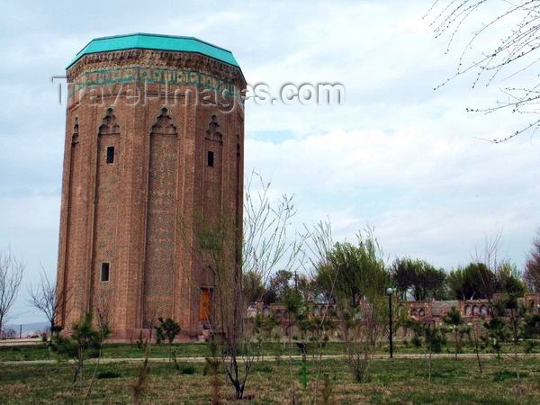
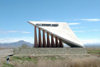
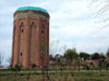 In
spite, or maybe because of such an agitated history, Nakhchivan is rich
in architectural heritage. Worth special notice are the mausoleum
of Momine Khatun (12-th century), the tomb of Yusuf Kuseir, mausoleum Garabaglar
with 2 minarets, the mausoleum of Fazlullah Naimi, the Khanega caravanserai,
the
Alindja castle and the ruins of the city of Gilan.
In
spite, or maybe because of such an agitated history, Nakhchivan is rich
in architectural heritage. Worth special notice are the mausoleum
of Momine Khatun (12-th century), the tomb of Yusuf Kuseir, mausoleum Garabaglar
with 2 minarets, the mausoleum of Fazlullah Naimi, the Khanega caravanserai,
the
Alindja castle and the ruins of the city of Gilan.
Transportation
The best way to get to Nakhchivan is to
fly from Baku to Jevlach airport, just outside the
exclave's capital (airport code: EVL), Azal operates a shuttle service,
heavily subsidized by the Azeri government. From Jevlach you can also fly
to Moscow with Samara airlines. If you are arriving from Baku there
is no passport check and you can simply walk out of the terminal. There
are buses and taxis to the city, which is only 3km away.
 If
you are travelling by land, you can also cross to and from Iran
at the Julfa border point, the city on the
other side is Jolfa (The other Azeri-Iranian border crossing is between
Astara and .... Astara!). There are trains to Tabriz.
If
you are travelling by land, you can also cross to and from Iran
at the Julfa border point, the city on the
other side is Jolfa (The other Azeri-Iranian border crossing is between
Astara and .... Astara!). There are trains to Tabriz.
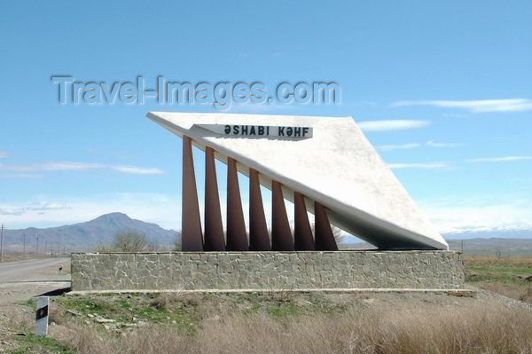
The exclave has a short border with Turkey
in Sadarak which allows an easy link to the city of Igdir. Have in mind
that the border is open only 10 hours a day and that border guards are
very corrupt. The nearest airport with connections to Ankara is at Erzurum
(ERZ), 250 kilometres west of Nakhchivan.
Inside the Republic the roads are in reasonable
condition, but encounters with the police make driving
less than advisable for foreigners (anyway police checks are less frequent
than in Azerbaijan proper).
GSM access is available in a good
part of Nakhchivan's territory via Azercell.
| A to Z of Azerbaijan
/ A dan Z ye Azerbaycan |
www.azerb.com
|