images of Nepal
Travel-Images.com
Nepalese flag - Federal Democratic Republic of Nepal / Népal / Sri Nepala Sarkar / Sanghiya Loktantrik Ganatantra Nepal images of
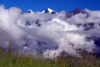
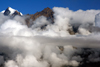
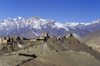
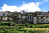
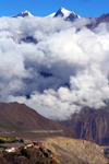
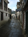
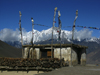
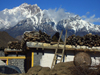
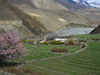
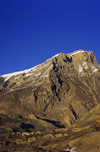
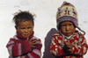
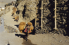
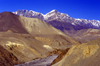
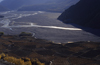
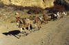
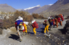
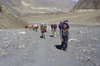
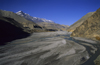
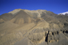
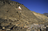
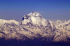
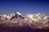
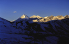
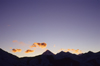
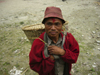
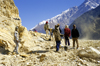
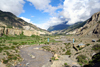
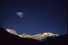
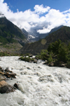
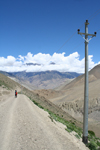
Nepal
12 - Annapurna circuit II - Dhawalagiri zone
Mustang, Jharkot, Jomsom, Myagdi, Ghorepani, Muktinath, Tukuche, Kali Gandaki, Dhaulagiri, Tipylang...
Central Nepal, Western Development Region - Himalaya
page 1
page 2
page 3
page 4
page 5
page 6
page 7
page 8
page 9
page 10
page 11
page 12
page 13
page 14
page 15
page 16
Annapurna region, Nepal: peaks, clouds and grass - view form Jharkot, Mustang district - photo by M.Wright Annapurna region, Dhawalgiri zone: peaks, clouds and grass - view form Jharkot, Mustang district Annapurna region, Nepal: peaks submerged in clouds - view form Jharkot, Mustang district - photo by M.Wright Annapurna region: peaks submerged in clouds - view form Jharkot, Mustang district


Jharkot, Annapurna Region, Mustang district, Nepal: village, 16th century fort, Shakyapa Gompa and mountains along the Muktinath valley - Bara Gaon area - photo by W.Allgöwer Jharkot, Annapurna Region, Mustang district: village, 16th century fort, Shakyapa Gompa and mountains along the Muktinath valley - Bara Gaon area Jharkot, Annapurna Region, Mustang district, Nepal: houses on the slope - photo by M.Wright Jharkot, Annapurna Region, Mustang District, Dhawalagiri Zone: houses on the slope
Annapurna region, Muktinath valley, Nepal: peaks, ridge and clouds - view form Jharkot, Mustang district - photo by M.Wright Annapurna region - Muktinath valley: peaks, ridge and clouds - view form Jharkot, Mustang district Marpha, Mustang District, Dhawalagiri Zone, Nepal: narrow stone paved street - Annapurna Circuit - photo by M.Samper Marpha, Mustang District, Dhawalagiri Zone: narrow stone paved street - Annapurna Circuit
Khingar, Mustang District, Dhawalagiri Zone, Nepal: house with prayer flags - tarcho - Annapurna Circuit - photo by M.Samper Khingar, Mustang District, Dhawalagiri Zone: house with prayer flags - Annapurna Circuit Khingar, Mustang district, Gandaki Zone, Nepal: storing wood on the roof - ladder - mountains - Annapurna Circuit - photo by M.Samper Khingar, Mustang District, Dhawalagiri Zone: storing wood on the roof - Annapurna Circuit
Tukuche, Mustang District, Dhawalagiri Zone, Nepal: child - Annapurna Circuit - photo by M.Samper Tukuche, Mustang District, Dhawalagiri Zone: child - Annapurna Circuit Kagbeni, Mustang district, Dhawalagiri Zone, Nepal: fields - agriculture in the Tibetan Plateau - Kali Gandaki river - Annapurna Circuit - photo by M.Samper Kagbeni, Mustang district, Dhawalagiri Zone: fields - agriculture in the Tibetan Plateau - Kali Gandaki river - Annapurna Circuit
Muktinath, Annapurna area, Mustang District, Dhawalagiri Zone, Nepal: Caravan Hotel, typical of the Annapurna circuit - photo by W.Allgöwer Muktinath, Annapurna area, Mustang District, Dhawalagiri Zone: Caravan Hotel, typical of the Annapurna circuit Muktinath, Annapurna area, Mustang District, Dhawalagiri Zone, Nepal: rural hospital - photo by W.Allgöwer Muktinath, Annapurna area, Mustang District, Dhawalagiri Zone: rural hospital
Muktinath, Annapurna area, Mustang District, Dhawalagiri Zone, Nepal: marble relief of the Hindu god Shiva - photo by W.Allgöwer Muktinath, Annapurna area, Mustang District, Dhawalagiri Zone: marble relief of the Hindu god Shiva Mustang district, Annapurna area, Dhawalagiri Zone, Nepal: village under a cliff - Annapurna Himal - photo by W.Allgöwer Mustang district, Annapurna area, Dhawalagiri Zone: village under a cliff - Annapurna Himal
Muktinath, Annapurna area, Mustang District, Dhawalagiri Zone, Nepal: Shiva temple - photo by W.Allgöwer Muktinath, Annapurna area, Mustang District, Dhawalagiri Zone: Shiva temple Muktinath, Annapurna area, Mustang district, Dhawalagiri Zone, Nepal: payer flags - 'tarcho' - photo by W.Allgöwer Muktinath, Annapurna area, Mustang district, Dhawalagiri Zone: payer flags - 'tarcho'
Mustang district, Annapurna area, Dhawalagiri Zone, Nepal: erosion - canyon - photo by W.Allgöwer Mustang district, Annapurna area, Dhawalagiri Zone: erosion - canyon Mustang district, Annapurna area, Dhawalagiri Zone, Nepal: village children - photo by W.Allgöwer Mustang district, Annapurna area, Dhawalagiri Zone: village children
Mustang district, Annapurna area, Dhawalagiri Zone, Nepal: donkey caravan - Kingdom of Lo - photo by W.Allgöwer Mustang district, Annapurna area, Dhawalagiri Zone: donkey caravan - Kingdom of Lo Upper Mustang, Annapurna area, Dhawalagiri Zone, Nepal: Kali Gandaki river - Kingdom of Lo - photo by W.Allgöwer Upper Mustang, Annapurna area, Dhawalagiri Zone: Kali Gandaki river - Kingdom of Lo
Upper Mustang, Annapurna area, Dhawalagiri Zone, Nepal: Kali Gandaki valley - photo by W.Allgöwer Upper Mustang, Annapurna area, Dhawalagiri Zone: Kali Gandaki valley Mustang district, Annapurna area, Dhawalagiri Zone, Nepal: mule caravan - Kingdom of Lo - photo by W.Allgöwer Mustang district, Annapurna area, Dhawalagiri Zone: mule caravan - Kingdom of Lo
Upper Mustang district, Annapurna area, Dhawalagiri Zone, Nepal: sherpas cross a stream - photo by W.Allgöwer Upper Mustang district, Annapurna area, Dhawalagiri Zone: sherpas cross a stream Upper Mustang district, Annapurna area, Dhawalagiri Zone, Nepal: sherpas on the Jomsom Trek - photo by W.Allgöwer Upper Mustang district, Annapurna area, Dhawalagiri Zone: sherpas on the Jomsom Trek
Upper Mustang, Annapurna area, Dhawalagiri Zone, Nepal: Kali Gandaki river, a tributary of the Ganga - Kingdom of Lo - photo by W.Allgöwer Upper Mustang, Annapurna area, Dhawalagiri Zone: Kali Gandaki river, a tributary of the Ganga - Kingdom of Lo Upper Mustang district, Annapurna area, Dhawalagiri Zone, Nepal: landscape on the Jmosom Trek - photo by W.Allgöwer Upper Mustang district, Annapurna area, Dhawalagiri Zone: landscape on the Jmosom Trek
Marpha, Annapurna area, Mustang District, Nepal: village view - Kali Gandaki valley - Annapurna Conservation Area - photo by W.Allgöwer Marpha, Annapurna area, Mustang District: village view - Kali Gandaki valley Jomsom / Dzongsam, Annapurna area, Mustang District, Nepal: donkeys on the slopes of the Kali Gandaki valley - photo by W.Allgöwer Jomsom / Dzongsam, Annapurna area, Mustang District: donkeys on the slopes of the Kali Gandaki valley
Nepal - Dhaulagiri Range, Myagdi District, Dhawalagiri Zone: Mt Dhaulagiri - Annapurna region, seen from the air - photo by A.Ferrari Dhaulagiri Range, Myagdi District, Dhawalagiri Zone: Mt Dhaulagiri - Annapurna region, seen from the air Nepal - Himalaya peaks, seen from the air - photo by A.Ferrari Himalaya peaks, seen from the air
Annapurna circuit, Myagdi District, Dhawalagiri Zone, Nepal: Dhaulagiri, the white mountain, 8167 m - the seventh highest mountain in the world - Dhaulagiri Himal, a subrange of the Himalaya - photo by W.Allgöwer Annapurna circuit, Myagdi District: Dhaulagiri, the white mountain, 8167 m - the seventh highest mountain in the world - Dhaulagiri Himal, a subrange of the Himalaya Annapurna circuit, Myagdi District, Dhawalagiri Zone, Nepal: Dhaulagiri at sunset - Dhaulagiri Himal - photo by W.Allgöwer Annapurna circuit, Myagdi District, Dhawalagiri Zone: Dhaulagiri at sunset - Dhaulagiri Himal
Tipylang, Myagdi District, Dhawalagiri Zone, Nepal: man with bamboo basket - dhoko - Annapurna Circuit - photo by M.Samper Tipylang, Myagdi District, Dhawalagiri Zone: man with bamboo basket - dhoko - Annapurna Circuit Annapurna area, Myagdi District, Dhawalagiri Zone, Nepal: Kali Gandaki valley - building a road in the Himalayas, Annapurna Himal - photo by W.Allgöwer Annapurna area, Myagdi District, Dhawalagiri Zone: Kali Gandaki valley - building a road in the Himalayas, Annapurna Himal
Annapurna region, Nepal: valley of the Kali Gandaki river - photo by M.Wright Annapurna region, Myagdi district, Dhawalagiri Zone: valley of the Kali Gandaki river Annapurna area, Myagdi District, Dhawalagiri Zone, Nepal: Tukuche peak and sky, 5920 m - photo by W.Allgöwer Annapurna area, Myagdi District, Dhawalagiri Zone: Tukuche peak and sky, 5920 m
Annapurna region, Nepal: rapids - Kali Gandaki river - photo by M.Wright Annapurna region, Myagdi district, Dhawalagiri Zone: rapids - Kali Gandaki river Annapurna region, Nepal: mountain road and telephone lines - photo by M.Wright Annapurna region: mountain road and telephone lines
Ghorepani, Parbat district, Dhawalagiri zone, Nepal: climbing to Pun hill / Poon hill - Annapurna region - photo by G.Friedman Ghorepani, Parbat district, Dhawalagiri zone: climbing to Pun hill Ghorepani, Parbat district, Dhawalagiri zone, Nepal: View Point lodge - photo by G.Friedman Ghorepani, Parbat district, Dhawalagiri zone: View Point lodge
page 1
page 2
page 3
page 4
page 5
page 6
page 7
page 8
page 9
page 10
page 11
page 12
page 13
page 14
page 15
page 16
credits: photos © by M.Wright, W.Allgöwer, M.Samper, G.Friedman / Travel-Images.com
main
image bank / agency   buy images
previous page next page (photos of Nepal)
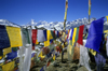
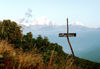
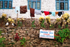
Images from the top of the world - a Nepalese panorama. Country between India and China. Capital: Kathmandu
see also: India, China, Bhutan, Pakistan, Myanmar (Burma), Tibet, Sri Lanka, Sikkim, Cambodia, Bangladesh, Kazakhstan, Maldives, Asia
click on the thumbnails to enlarge the images - photos - Nepal image library - Bilder - imágenes
images of Nepal
by
www.travel-images.com