images of Pakistan
Travel-Images.com
Pakistan / Paquistão / Pakistâna / Pakisztán / Paquistán - flag images of
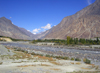
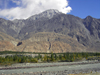
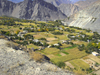
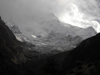
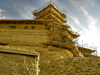
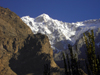
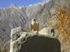
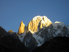
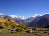
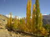
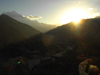
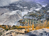
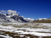
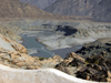
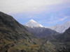
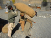
Pakistan
4 - Northern Areas II: along the Karakoram Highway / KKH
PAGE 1
PAGE 2
PAGE 3
PAGE 4
PAGE 5
PAGE 6
PAGE 7
Baluchistan
Punjab
Northern Areas
NW Frontier
Islamabad
Sindh
Hunza Valley - Northern Areas, Pakistan: following the Hunza River - Karakoram Highway - N35 - KKH - Hunza tour - photo by D.Steppuhn Hunza Valley - Northern Areas: following the Hunza River - Karakoram Highway - N35 - KKH - Hunza tour Hunza Valley - Northern Areas, Pakistan: mountains along the Hunza River - Karakoram Highway - N35 - KKH - Hunza tour - photo by D.Steppuhn Hunza Valley - Northern Areas: mountains along the Hunza River - Karakoram Highway - N35 - KKH - Hunza tour


Hunza Valley - Northern Areas, Pakistan: agriculture in the scarce fertile land surrounded by mountains - Karakoram Highway - photo by D.Steppuhn Hunza Valley - Northern Areas: agriculture in the scarce fertile land surrounded by mountains - Karakoram Highway Nilt, Gilgit District - Northern Areas, Pakistan: view of the Rakaposhi Peak - 7,788 metres - Karakoram mountain range - Nagar Valley - photo by D.Steppuhn Nilt, Gilgit District - Northern Areas: view of the Rakaposhi Peak - 7,788 metres - Karakoram mountain range - Nagar Valley
Karimabad / Baltit - Northern Areas, Pakistan: riding is better than walking - crowded Chinese made pick-up truck - Hunza Valley - KKH - photo by D.Steppuhn Karimabad / Baltit - Northern Areas: riding is better than walking - crowded Chinese made pick-up truck - Hunza Valley - KKH Karimabad / Baltit - Northern Areas, Pakistan: Rakaposhi peak and Baltit fort - Hunza Valley - KKH - photo by D.Steppuhn Karimabad / Baltit - Northern Areas: Rakaposhi peak and Baltit fort - Hunza Valley - KKH
Karimabad / Baltit - Northern Areas, Pakistan: Baltit fort, once used by the Mirs of Hunza - now a museum run by the Baltit Heritage Trust - Hunza Valley - KKH - photo by D.Steppuhn Karimabad / Baltit - Northern Areas: Baltit fort, once used by the Mirs of Hunza - now a museum run by the Baltit Heritage Trust - Hunza Valley - KKH Altit village, Karimabad - Hunza valley, Northern Areas, Pakistan: Altit fort - once the residence of the Mirs of Hunza, an independent princely state for a thousand years - photo by G.Frysinger Altit village, Karimabad - Hunza valley: Altit fort - once the residence of the Mirs of Hunza, an independent princely state for a thousand years
Karimabad / Baltit - Northern Areas, Pakistan: Baltit fort - kitchen utensils in the museum - Hunza Valley - photo by D.Steppuhn Karimabad / Baltit - Northern Areas: Baltit fort - kitchen utensils in the museum - Hunza Valley Pakistan - Karimabad (formerly called Baltit) - Northern Areas province: little girl running - photo by A.Summers Karimabad / Baltit: little girl running
Karimabad / Baltit - Northern Areas, Pakistan: Baltit fort - roof pavillion - Hunza Valley - photo by D.Steppuhn Karimabad / Baltit - Northern Areas: Baltit fort - roof pavillion - Hunza Valley Karimabad / Baltit - Northern Areas, Pakistan: the village and the Hunza Valley seen from Baltit fort - KKH - photo by D.Steppuhn Karimabad / Baltit - Northern Areas: the village and the Hunza Valley seen from Baltit fort - KKH
Karimabad / Baltit - Northern Areas, Pakistan: Ultar Sar peak, Batura Muztagh, a subrange of the Karakoram range - seen from Baltit fort - KKH - photo by D.Steppuhn Karimabad / Baltit - Northern Areas: Ultar Sar peak, Batura Muztagh, a subrange of the Karakoram range - seen from Baltit fort - KKH Karimabad / Baltit - Northern Areas, Pakistan: window over the village and the Hunza Valley - Baltit fort - KKH - photo by D.Steppuhn Karimabad / Baltit - Northern Areas: window over the village and the Hunza Valley - Baltit fort - KKH
Karimabad / Baltit - Northern Areas, Pakistan: the village seen from Baltit fort - traditional settlement structure with terraced houses - KKH - photo by D.Steppuhn Karimabad / Baltit - Northern Areas: the village seen from Baltit fort - traditional settlement structure with terraced houses - KKH Karimabad / Baltit - Northern Areas, Pakistan: the village and Baltit fort under the Karakoram mountains - KKH - photo by D.Steppuhn Karimabad / Baltit - Northern Areas: the village and Baltit fort under the Karakoram mountains - KKH
Karimabad / Altit - Northern Areas, Pakistan: traditional architecture - Karimabad is named after Prince Karim Agha Khan, head of the Shia Ismaili Nizari sect - photo by D.Steppuhn Karimabad / Altit - Northern Areas: traditional architecture - Karimabad is named after Prince Karim Agha Khan, head of the Shia Ismaili Nizari sect Altit village, Karimabad - Hunza valley, Northern Areas, Pakistan: Altit fort under renovation - photo by D.Steppuhn Altit village, Karimabad - Hunza valley, Northern Areas: Altit fort under renovation
Karimabad / Baltit - Northern Areas / FANA, Pakistan: peaks in the Karakoram mountain range - photo by D.Steppuhn Karimabad / Baltit - Northern Areas / FANA: peaks in the Karakoram mountain range Diram peak - Northern Areas / FANA, Pakistan: 7266 m - Karakoram mountain range - KKH - photo by D.Steppuhn Diram peak - Northern Areas / FANA: 7266 m - Karakoram mountain range - KKH
Duikar hamlet, Altit - Northern Areas, Pakistan: eagle at Eagles' Nest hotel - photo by D.Steppuhn Duikar hamlet, Altit - Northern Areas: eagle at Eagles' Nest hotel Karimabad / Baltit - Northern Areas / FANA, Pakistan: Lady Finger (6000m) and Ultar Sar peak (7233n) at sunrise - Batura Muztagh, Karakoram range - photo by D.Steppuhn Karimabad / Baltit - Northern Areas / FANA: Lady Finger (6000m) and Ultar Sar peak (7233n) at sunrise - Batura Muztagh, Karakoram range
Duikar hamlet, Altit - Northern Areas, Pakistan: view to Sleeping Beauty from Eagles' Nest hotel - Hunza valley - photo by D.Steppuhn Duikar hamlet, Altit - Northern Areas: view to Sleeping Beauty from Eagles' Nest hotel - Hunza valley Duikar hamlet, Altit - Northern Areas, Pakistan: trees and the Hunza valley - photo by D.Steppuhn Duikar hamlet, Altit - Northern Areas: trees and the Hunza valley
Duikar hamlet, Altit - Northern Areas, Pakistan: sunset in the Karakoram mountains - photo by D.Steppuhn Duikar hamlet, Altit - Northern Areas: sunset in the Karakoram mountains Karimabad / Baltit - Northern Areas / FANA, Pakistan: the village and the Hubza canyon - photo by D.Steppuhn Karimabad / Baltit - Northern Areas / FANA: the village and the Hubza canyon
Khunjerab Pass, Hunza valley, Northern Areas / FANA - Pakistan-administered Kashmir: Chinese bus brings doing the Hunza tour - KKH - photo by D.Steppuhn Khunjerab Pass, Hunza valley, Northern Areas: Chinese bus brings doing the Hunza tour - KKH Khunjerab Pass, Hunza valley, Northern Areas / FANA - Pakistan-administered Kashmir: sign with road distances into Pakistan - KKH - photo by D.Steppuhn Khunjerab Pass, Hunza valley, Northern Areas: sign with road distances into Pakistan - KKH
Khunjerab Pass, Hunza valley, Northern Areas / FANA - Pakistan-administered Kashmir: sign in Urdu and English - border between Pakistan and China - Xinjian Uighur Autonomous Region - KKH - photo by D.Steppuhn Khunjerab Pass, Hunza valley, Northern Areas / FANA - Pakistan-administered Kashmir: sign in Urdu and English - border between Pakistan and China - Xinjian Uighur Autonomous Region - KKH Khunjerab Pass, Hunza valley, Northern Areas / FANA - Pakistan-administered Kashmir: old Silk Road trail - gorge with with small bridge - KKH - photo by D.Steppuhn Khunjerab Pass, Hunza valley, Northern Areas: old Silk Road trail - gorge with with small bridge - KKH
Pakistan - Passu - Upper Hunza / Gojal region - Northern Areas: rickety suspension bridge over the Khunjrab river - photo by A.Summers Passu - Upper Hunza / Gojal region: rickety suspension bridge over the Khunjrab river Passu, Gojal tehsil, Khunjerab Pass, Hunza valley, Northern Areas / FANA - Pakistan-administered Kashmir: the Cathedral Ridge - Karakoram Highway - KKH - photo by D.Steppuhn Passu, Gojal tehsil, Khunjerab Pass, Hunza valley, Northern Areas: the Cathedral Ridge - Karakoram Highway - KKH
Gilgit district - Northern Areas, Pakistan: bridge over the Hunza river - Karakoram Highway - N35 - KKH - photo by D.Steppuhn Gilgit district - Northern Areas: bridge over the Hunza river - Karakoram Highway - N35 - KKH Gilgit - Northern Areas / FANA, Pakistan: petroglyphs along the KKH - ancient rock carvings - feretory / stupa and Buddhist figures - stone art from 800 AD - Karakoram Highway - photo by D.Steppuhn Gilgit - Northern Areas: petroglyphs along the KKH - ancient rock carvings - feretory / stupa and Buddhist figures
Pakistan - Gilet - Northern Areas: Pakistani groom ready for the wedding - tradition - photo by Galen Frysinger Gilgit: Kashmiri groom ready for the wedding Pakistan - Gilet - Northern Areas: an ancient tomb surrounded by corn fields - photo by G.Frysinger Gilgit: an ancient tomb surrounded by corn fields
Pakistan - Gilet / Gilgit - Northern Areas: Churchill fort - explored by a young Winston Churchill when he was recuperating from a gunshot wound - photo by G.Frysinger Gilgit: "Churchill" fort - explored by a young Winston Churchill when he was recuperating from a gunshot wound Pakistan - Gilit / Gilgit (Northern Areas): armed jeep - Pakistani military - army - machine gun - photo by A.Summers Gilgit: armed jeep - Pakistani military
Khunjerab Pass, Hunza valley, Northern Areas / FANA - Pakistan-administered Kashmir: plateau at 4900 m and the mountains of Kashmir - highest section of the Karakoram Highway leading to China - inspiration for the mythical valley of Shangri-la - KKH - photo by D.Steppuhn Khunjerab Pass, Hunza valley, Northern Areas: plateau at 4900 m and the mountains of Kashmir - highest section of the Karakoram Highway leading to China - inspiration for the mythical valley of Shangri-la Gilgit district - Northern Areas, Pakistan: the Gilgit river joins the Indus river - junction point - Karakoram Highway - photo by D.Steppuhn Gilgit district - Northern Areas: the Gilgit river joins the Indus river - junction point - Karakoram Highway
Gulmit, Gojal tehsil, Khunjerab Pass, Hunza valley, Northern Areas / FANA - Pakistan-administered Kashmir: snowy mountain peaks - Khunjerab National Park - KKH - photo by D.Steppuhn Gulmit, Gojal tehsil, Khunjerab Pass, Hunza valley, Northern Areas: snowy mountain peaks - Khunjerab National Park - KKH Sust / Sost, Gojal tehsil, Hunza valley, Northern Areas / FANA - Pakistan-administered Kashmir: loading potatoes near the Asia Star hotel - KKH - photo by D.Steppuhn Sust / Sost, Gojal tehsil, Hunza valley, Northern Areas: loading potatoes near the Asia Star hotel - KKH
PAGE 1
PAGE 2
PAGE 3
PAGE 4
PAGE 5
PAGE 6
PAGE 7
Baluchistan
Punjab
Northern Areas
NW Frontier
Islamabad
Sindh
credits: photos © by D.Steppuhn, G.Frysinger, A.Summers / Travel-Images.com
 buy images
image bank / agency   main
previous page (photos of Pakistan: Punjab)
next page (photos of Pakistan)
Pakistan. Country in the indian subcontinet. Punjab, Afghan Frontier, Kashmir, Baluchistan. Capital: Islamabad
see also: Asia, Middle East, India, Afghanistan, Nepal, Bhutan, China, Tajikistan, Syria, Turkmenistan, Sri-Lanka, Bangladesh, Iran, England, Portugal
click on the thumbnails to enlarge the images - photos of Pakistan - image bank - stock photography - image bank - Bilder
images of Pakistan
by
www.travel-images.com