| Kelbajar (Kelbacar, Karavajar) |
Azerb.com
|
Kelbajar
is located in a heavily-forested area, surrounded by tall mountains. It
is best described simply by the translation of its name: "high village
on a tall pass" (the Armenian name is Karavajar). The area benefits from
alpine scenarios and beauty.
It became notorious for the surprising longevity of its inhabitants, in some case alegedely over 140 years!! Probably this phenomenon is related to the abundant medicinal mineral springs in the area.
 If
you have time to spend in the area don't miss the landscape on the Terter
canyon, as well as the nearby monasteries of Khotavank and Gandzasar, which
seem to date from the ancient Albanians (no relation to the present date
state! see history)
If
you have time to spend in the area don't miss the landscape on the Terter
canyon, as well as the nearby monasteries of Khotavank and Gandzasar, which
seem to date from the ancient Albanians (no relation to the present date
state! see history)
Kelbajar is not located in Nagorno-Karabakh proper, but in the narrow strip of territory between it and Armenia. As a consequence of the war, since April 1993 this strip of territory is still under the control of Armenian troops. The area has gold mines, a fact which may makes the return of Kelbajar to Azerbaijan more difficult.
In the present cold peace climate, in order to reach Kelbajar you must go trough Armenia. This should not be very difficult as the Nagorno-Karabakh (Artsakh) region is eager to welcome tourists. See the section on visas, for details.
Before the war there was an important Kurdish minority in the area, part of which has been internally dislocated. The town of Kelbazar was part of the short-lived (1923-1929) 'Kurdish Autonomous Province' or 'Red Kurdistan', which had its capital in Lachin.
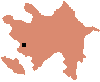
(320 km west of Baku)
| see also: maps, Lachin, Nagorno-Karabakh, Kurdish, geography, people, summary, places, photos |
| A to Z of Azerbaijan / A dan Z ye Azerbaycan |
www.azerb.com
|