| Geography
of Azerbaijan |
Azerb.com
|
| |
|
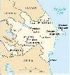
| Location:Azerbaijan
occupies the southeastern part of the Caucasus, descending to the Caspian
Sea, between Iran and the Russian Federation (Dagestan). The country is
somewhere between Europe and Asia, as the Caucasus mountains are the conventional
border between the two continents. So, the northeast half is in Europe
and the southwest half is in Asia. Have this in mind, when looking for
Azerbaijan, since you never know if it is classified under 'Europe' or
under 'Asia'. (Azerbaijan is a member of the Council of Europe.)
Azeris like to describe
the country as 'shapped like an eagle', with its wings spread on the Caucasus
and its head over the Caspian (its head being the Absheron peninsula).
Try our sensitive map if you need inforation
about Azeri cities and towns.
Geographic co-ordinates:
40 30 N, 47 30 E (380 25"-410 55" of n.l. and 440 50"-500 52" e.l.)
The time zone in Azerbaijan is
GMT
+4
see:
maps,
places,
time
zones |
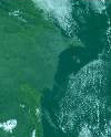
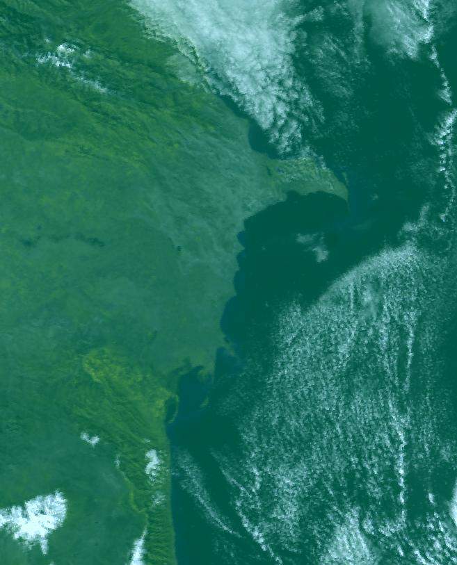
Azerbaijan
from space
Photo: SRI (Moscow)
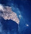
Baku
from space
Photo: NASA
|
Area:
-total: 86,600 km2
-land: 86,100 km2
-water: 500 km2
-comparative: slightly
smaller than Portugal
The total area includes
the exclave of Naxcivan Autonomous Republic as well as the Nagorno-Karabakh
region (Daqliq Qarabaq); the autonomy of the latter was abolished by the
Azerbaijani Supreme Soviet on 26 November 1991 (Nagorno-Karabakh and some
adjacent areas are currently still not controlled by the Azeri government).
In addition to the continental part, the republic's territory also includes
several islands located along the Caspian coastline. |
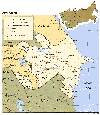
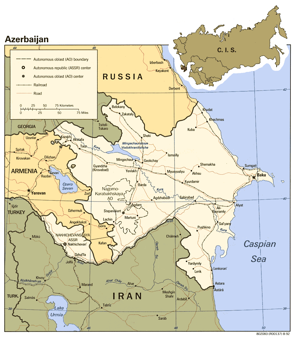
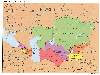
Map
of Azerbaijan
MORE
MAPS
|
Land frontiers:
-total: 2,013 km
-border countries:
| Armenia
(with Azerbaijan-proper) |
566 km
|
|
Armenia (with Azerbaijan-Naxcivan exclave) |
221
km
|
|
Georgia |
322
km
|
|
Iran (with Azerbaijan-proper) |
432
km
|
|
Iran (with Azerbaijan-Naxcivan exclave) |
179
km
|
|
Russian Federation (Daguestan) |
284
km
|
|
Turkey (with Azerbaijan-Naxcivan exclave) |
9 km
|
- - - - - - - - - -
- - - - - - - - - - - - - - - - - - - - - - - - - - - - - - - - - - - -
- - - - - - - - - - - - - - - - - - - - - - -- - - - - - - - - |
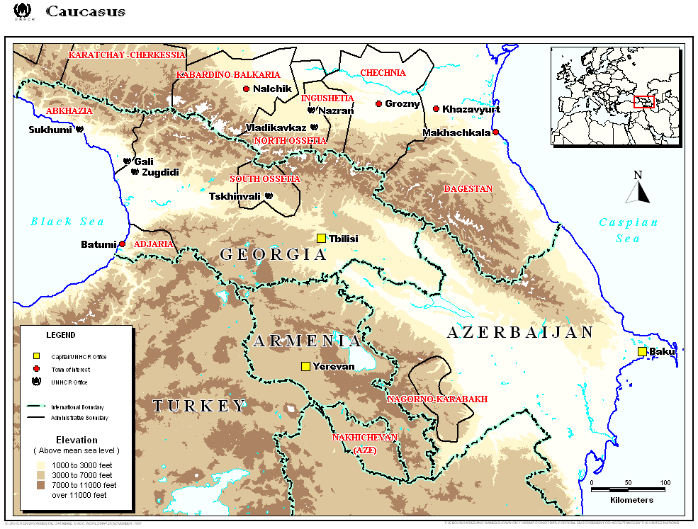
Caucasus:
borders
Caucasus/Central
Asia
|
Coastline: Azerbaijan
borders the Caspian Sea (800 km). There are three large projections: the
Absheron peninsula, the Sara peninsula and the Kura sand bar.
Topography:
The elevation changes over a relatively
short distance from lowlands to highlands; nearly half the country is considered
mountainous. Notable physical features are the gently undulating hills
of the subtropical southeastern coast, which are covered with tea plantations,
orange groves, and lemon groves; numerous mud
volcanoes and mineral springs in the ravines of Kobustan Mountain near
Baku; and coastal terrain that lies as much as twenty-eight meters below
sea level.
Except for its eastern Caspian shoreline
and some areas bordering Georgia and Iran, Azerbaijan is ringed by mountains.
To the northeast, bordering Russia's Dagestan Autonomous Republic, is the
Greater Caucasus range; to the west, bordering Armenia, is the Lesser Caucasus
range. To the extreme southeast, the Talysh Mountains form part of the
border with Iran. The highest elevations occur in the Greater Caucasus,
where Mount Bazarduzu rises 4,740 meters above sea levelto
the southwest is the massive Transcaucasian upland extending to Armenia
and Georgia, mounted by the Lesser Caucasus, to the south the Talysh Mountains
join them. Only about 15 percent of the land in Azerbaijan is arable.
Baku
lies on Abseron (Apsheron) Peninsula that juts into Caspian Sea.
Eight large rivers
flow down from the Caucasus ranges into the central Kura-Aras lowlands,
alluvial flatlands and low delta areas along the seacoast designated by
the Azerbaijani name for the Mtkvari River (Kura) and its main tributary,
the Aras. The Kura, the longest river in the Caucasus region rises in Georgia
and flows southeast , forms the delta and drains into the Caspian a short
distance downstream from the confluence with the Aras. The lower 500km
are navigable and prone to flooding. Large-scale canals divert water, primarily
for agricultural purposes. The Aras rises in eastern Turkey, defines
the Nakhchivan / Iran, Armenia / Iran and Azerbaijan / Iran borders before
entering Azerbaijan southeast of Imishly, some historians argue that the
Aras is the biblical river of Gihon.
The Verkhne-Karabakhskiy Canal channels
water from the Mingäçevir Reservoir on the upper Kura to the
Aras River. The Samur-Apsheronskiy Canal redirects water from the Samur
River on Azerbaijan's northern border to the Apsheron Peninsula. The Mingechaur
Reservoir, with an area of 605 square kilometers that makes it the largest
body of water in Azerbaijan, was formed by damming the Kura in western
Azerbaijan. The waters of the reservoir provide hydroelectric power and
irrigation of the Kura-Aras plain. Most of the country's rivers are not
navigable.
|
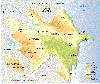
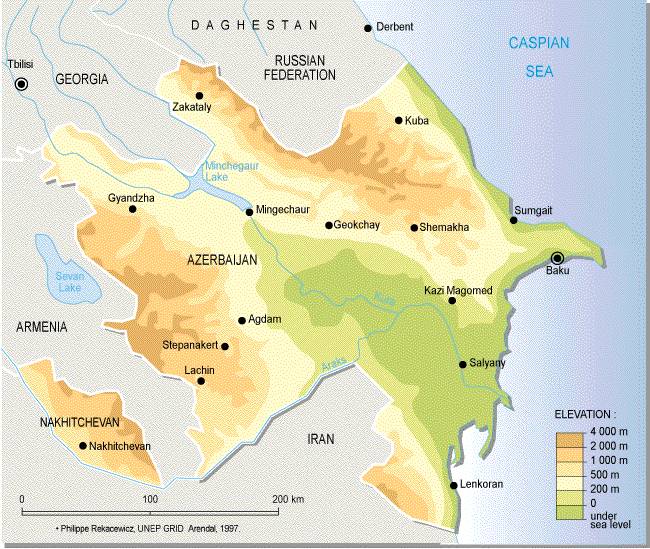
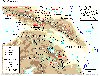
Topography
Sensitive
map
Kura
river
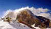
Mount
Shahdag
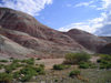
Candy
Canyon
|
Elevation extremes:
-lowest point: Caspian
Sea -28 m
-highest point:
Bazarduzu Dagi 4,466 m
Natural resources:
petroleum,
natural gas, iron ore, non-ferrous metals, alumina
 Land
use:
Land
use:
-arable land: 18%
-permanent crops:
5%
-permanent pastures:
25%
-forests and woodland:
11%
-other: 41% (1993
est.)
-irrigated land:
10,000 km2 (1993 est.)
 Natural
hazards:
Natural
hazards:
-prolonged droughts;
-some lowland areas
threatened by rising levels of the Caspian,
-earthquakes occur
on a regular basis: in 1667 a major earthquake destroyed Shemakha killing
over 80,000. The most recent earthquake happened shook the country in November
2000, with magnitude 6.3 in the Richter scale, killing over 30, an causing
significant material damage, particularly in Baku, Sumgait and the rest
of the Absheron peninsula.
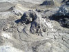 -Azerbaijan
also has a lot of "mud volcanoes", which are an interesting sight,
but to which some distance is recommended due to their unpredictable behaviour.
Should you interested, the best places to find these midget volcanoes are
the areas near Alat and Gobustan.
-Azerbaijan
also has a lot of "mud volcanoes", which are an interesting sight,
but to which some distance is recommended due to their unpredictable behaviour.
Should you interested, the best places to find these midget volcanoes are
the areas near Alat and Gobustan.
see also: fauna,
flora,
environment,
cities
and towns
 The
formation of climate in Azerbaijan is influenced by cold air masses coming
from the arctic (Kara and Scandinavian anticyclones) and temperate (Siberian
anticyclones) and maritime (Azores anticyclone), hot air masses of tropical
zones (subtropical anticyclone and southern cyclones), Central Asian anticyclones
and local weather conditions.
The
formation of climate in Azerbaijan is influenced by cold air masses coming
from the arctic (Kara and Scandinavian anticyclones) and temperate (Siberian
anticyclones) and maritime (Azores anticyclone), hot air masses of tropical
zones (subtropical anticyclone and southern cyclones), Central Asian anticyclones
and local weather conditions.
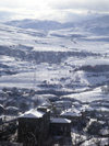
The climate varies
from subtropical and dry in central and eastern Azerbaijan to subtropical
and humid in the southeast (Lenkoran lowlands), temperate along the shores
of the Caspian Sea, and cold at the higher mountain elevations.
In Baku
the climate is cool in the winter, averaging 4 degrees C in January.
Summers are hot, up to 40 degrees C, and humid because of the sea. There
are often strong winds, especially in winter. Snow rarely settles
in the city. Spring and autumn are pleasant and there is a great deal of
sunshine from April to October.
 Because
most of Azerbaijan receives scant rainfall - on average 152 to 254 millimeters
annually - agricultural areas require irrigation. Heaviest precipitation
occurs in the highest elevations of the Caucasus and in the Lenkoran' Lowlands
in the far southeast, where the yearly average exceeds 1,000 millimeters.
Because
most of Azerbaijan receives scant rainfall - on average 152 to 254 millimeters
annually - agricultural areas require irrigation. Heaviest precipitation
occurs in the highest elevations of the Caucasus and in the Lenkoran' Lowlands
in the far southeast, where the yearly average exceeds 1,000 millimeters.
| A to Z of Azerbaijan
/ A dan Z ye Azerbaycan |
www.azerb.com
|